REGIONAL SPECIALIZED METEOROLOGICAL CENTER (BEIJING) FOR ATMOSPHERIC SAND AND DUST STORM FORECASTING
(RSMC-ASDF BEIJING)
SAND AND DUST STORM WARNING ADVISORY AND ASSESSMENT SYSTEM ASIAN REGIONAL CENTER
(SDS-WAS ASIAN-RC)
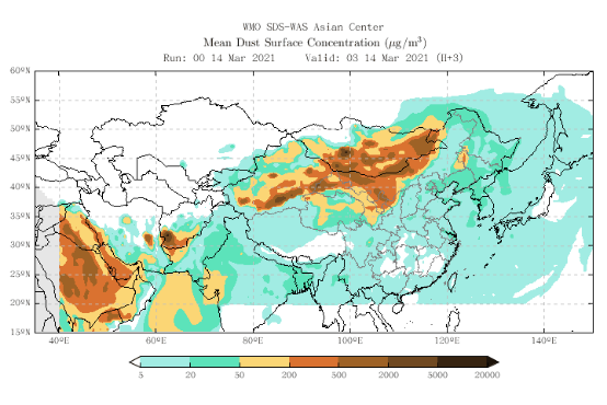
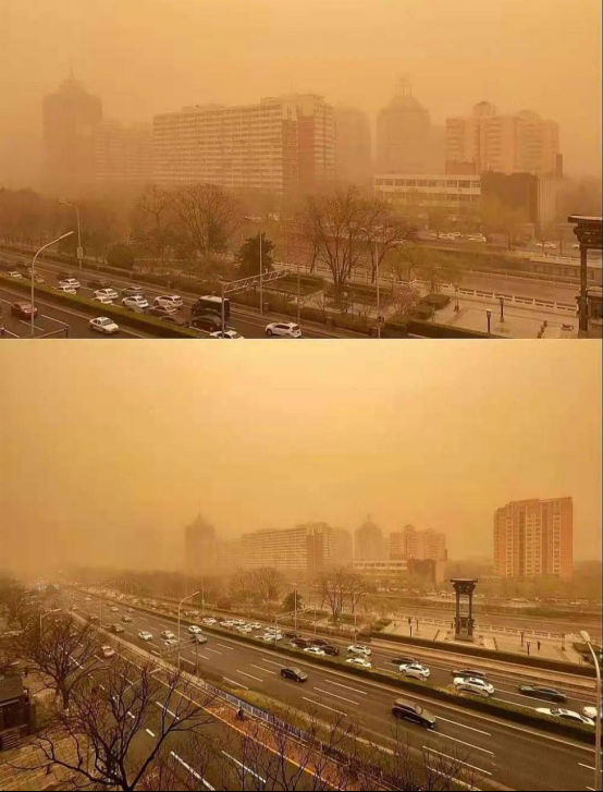
On 14 March 2021, influenced by the strong Mongolian cyclone(Central sea level air pressure 980hPa) and its rear cold air, Mongolia had a large range of strong SDS, with the instantaneous wind force reaching 10-12 levels. On the night of the 14th, the cyclone moved to the South with the cyclone moving to the East, and a large range of SDS began to occur in the Midwest of Inner Mongolia China. As of this afternoon (15th), the eastern part of Xinjiang, Inner Mongolia, Gansu, Ningxia, Shanxi, Hebei, Heilongjiang had appeared In Jilin, Liaoning, Beijing, Tianjin and other places, sand or dust has been lifted successively. In Inner Mongolia, western Gansu, northern Ningxia, northern Shanxi, northern Hebei, Beijing Tianjin and other places, there are sandstorms or severe sandstorms. In Inner Mongolia, northwest, North China and Northeast China, there are 6-8 gales, with gusts of 10-11. Due to the influence of SDS, the minimum visibility of many places has decreased to less than 500 meters. Statistics show that the process is the strongest SDS process in China in recent 10 years. In many places, PM10 burst table appears. In Inner Mongolia, Gansu, Ningxia, northern Hebei and Beijing, PM10 peak concentration exceeds 5000 μg/m3 The peak PM10 concentration in Beijing is over 9000 μ g/m3.
It is expected that the SDS will gradually weaken on the 15th, but on the 16th, SDS will still occur in Northwest, North China, Huanghuai and Jianghuai areas affected by the SDS transport.(WMO RSMC-ASDF BEIJING)

Fig.1 WMO SDS-WAS Asian Center SDS Mean dust concentration chart released on 14 Mar. 2021

Fig.2 Cities affected by dust on 15 Mar. 2021